Thursday, 27th May 2021
19C,and sunny. The best weather we have had, this trip, if not this year! How long will it last?
We need a few groceries, a walk is planned, to include passing the shops in Denham Green.
There is a bridle path, which I recall we walked along on a previous visit. It heads in the general direction we want to go.Sure enough, we arrive at the A412 (which passes through Denham Green), but, it a busy road to walk along (no footpath).
Memory from last trip, says we should cross the road and go straight ahead, but, the way is barred by HS2 works.
There is a path through the trees, which, appears to head in the right direction, off we go, with Kathleen in the lead.
We eventually run out of path, and, we can no longer see or hear the road.
I am so pleased I was not in front!, but, needless to say, "getting lost" is still my fault. Apparently, I 'told her which way to go", as anyone knows, you do not "tell" a McCaffery anything, particularly a "McCaffery woman". Life is such fun ;)
We eventually find our way back to the main road (A412), and, do the sensible thing, ie follow the road. Sure enough, we come to Denham Green and the COOP Supermarket.After lunch, we make the most of the sunshine, and sit reading books.
Later, we explore another nearby bridle path. About a mile in, it becomes very wet and muddy.
Kathleen has spent quite a while cleaning her shoes, after this morning's "adventure", so, no repeat this afternoon, we turn back.
Friday, 28th May 2021
Cloudy, but, mild, and, most importantly, not raining. 19C is promised for today.
During Covid lock-down, I began to do various CycleChat Challenges, to relieve the boredom, and, provide a reason to get out in the fresh air and do some exercise. One of the challenges is ABC of Town and Village names. I am currently at "H", with "I" needed next.
I notice that there is a place called Iver, not too far away.
I use Cycle-Routes website to plot a suitable route, and load it into my Garmin Edge. It is all rather clever, the Cycle-Routes Website, will automatically transfer the GPS Route to Garmin Connect, and Garmin Express will automatically loads it into the Garmin Edge.
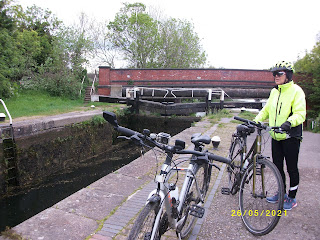
Off we go, 13 miles of quiet roads, or, Cycle Paths, plus, a stretch along the Towpath of the Grand Union Canal.Actually, the technology does not work quite flawlessly, the Garmin plots our route fine, but, it does not record my statistics, distance, speed etc, so, I have to rely on Kathleen's Runkeeper log. There must be a way, next time!
I get my Cyclechat Challenge photographs, with Iver Village, and, a bonus "bike on a bridge", as we go over the M25 Motorway.Yes, I am obsessed, Kathleen already told me ;)
Now, or course, we have to find our way back. The route here was quite complicated, with lots of turns, we (well, I) decide, the easier option is to make our way to Uxbridge, then,
follow the canal back to The Bear on The Barge Pub, at which point, turn. off towards Wyatts Covert.All goes well, we even come upon a pub (The General Elliot), by the canal, in Uxbridge, where we stop for lunch.
We have been here before, some five years ago, when out cycling with Gary.
I have a little fun, trying to emulate Doug's photographs, taken, I assume, using a timer.
My camera has a timer function. I manage to get it to work, but, I think I need to work on the steadiness of the camera stand, obviously, balanced on my cycling helmet does not surfice.


